Zaži Tatry
An app, you won't get lost in Tatras with.
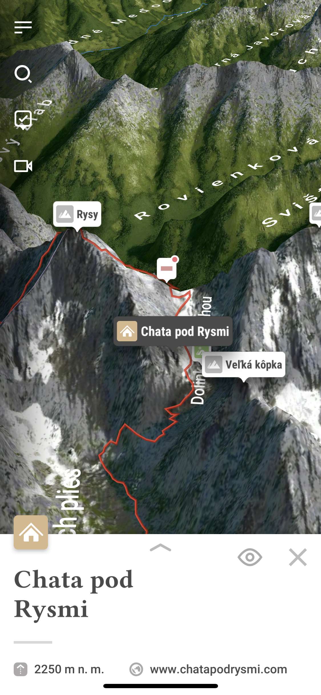
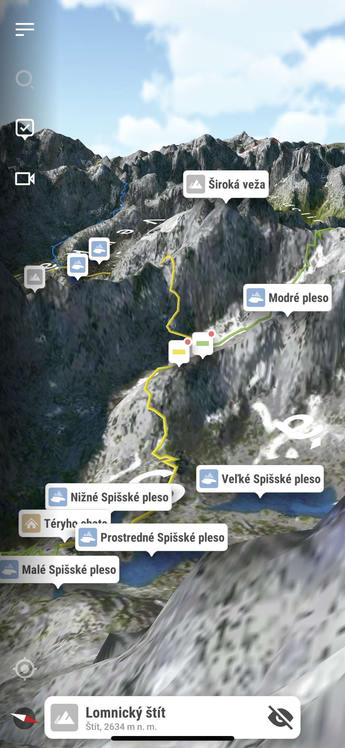
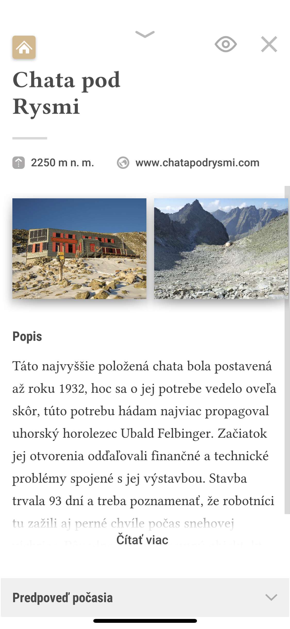
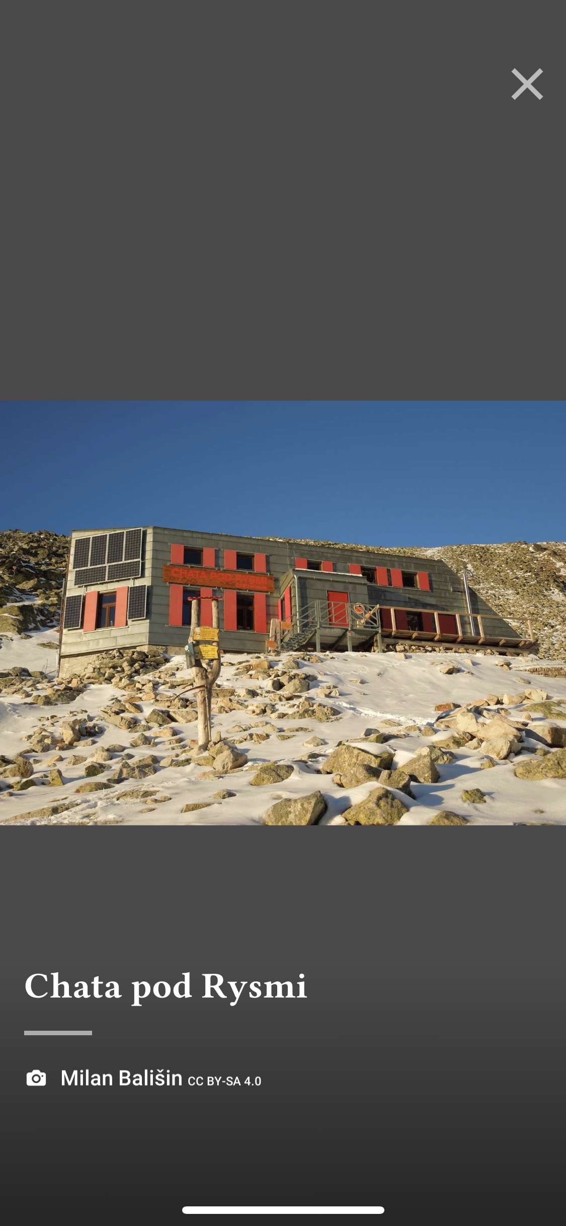
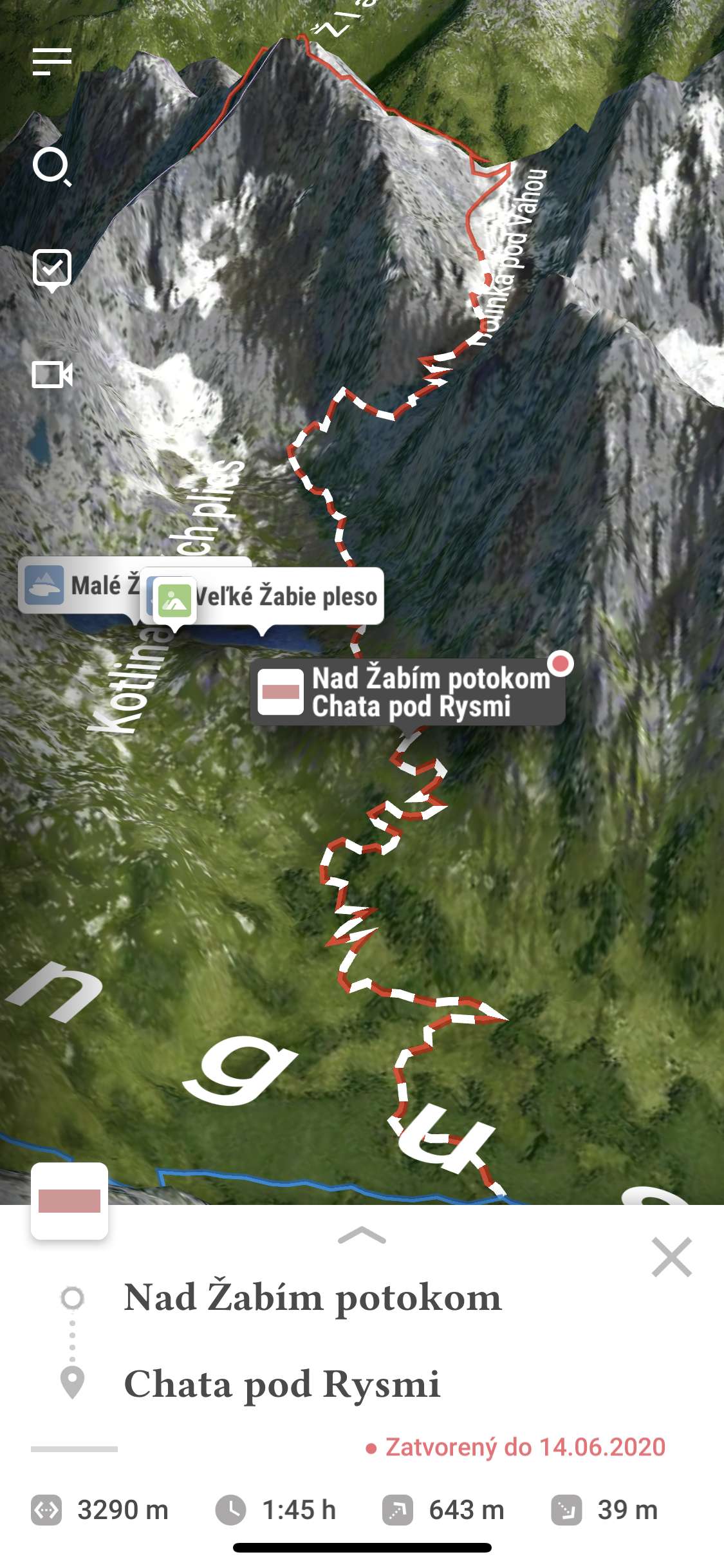
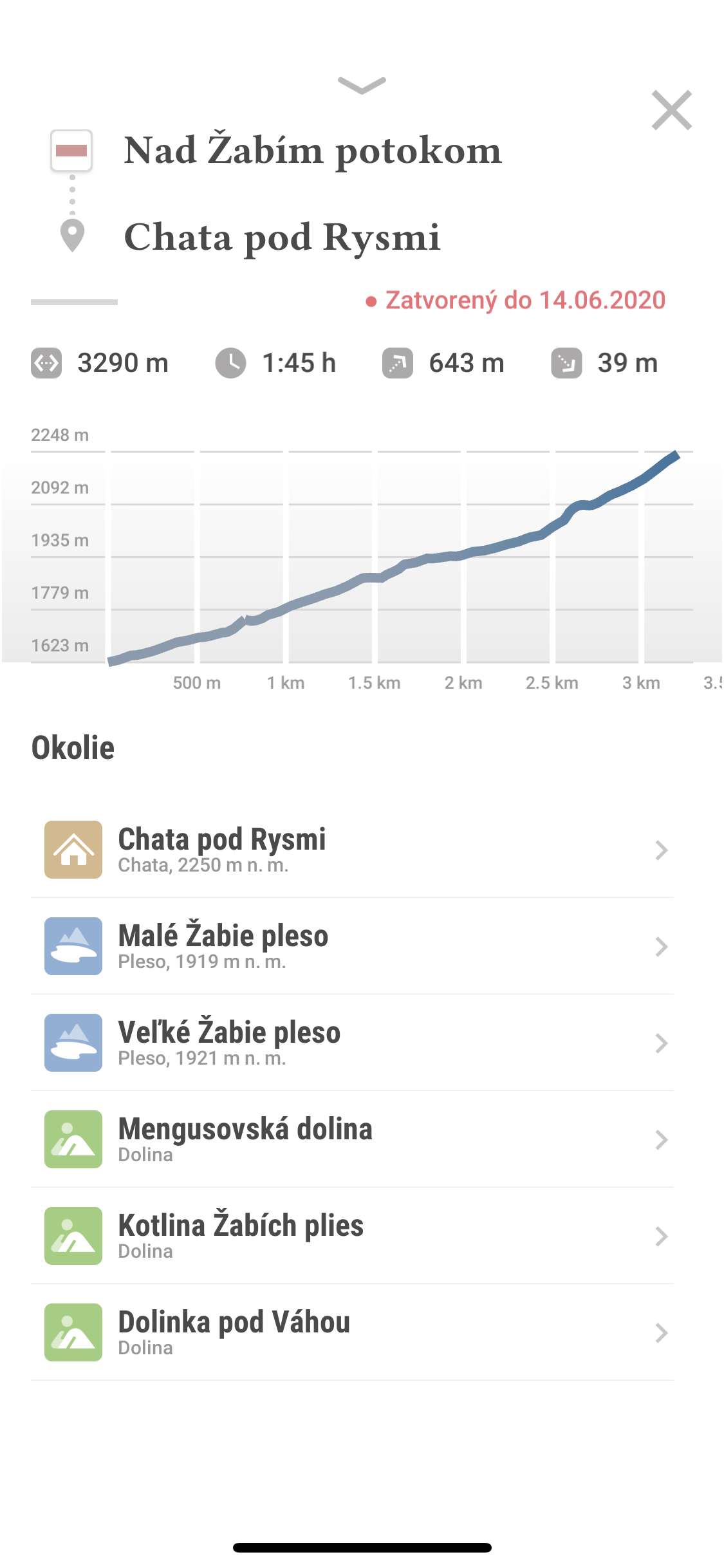
Pack it into your phone or tablet and get a 3D map with hiking trails, cable cars, navigation, descriptions of peaks, valleys, lakes and cottages.
An app, you won't get lost in Tatras with.
Pack it into your phone or tablet and get a 3D map with hiking trails, cable cars, navigation, descriptions of peaks, valleys, lakes and cottages.
Version 2.0 | What's new?
"The best relax #tatras most beautiful valley #malastudenadolina and with app Zaži Tatry a new dimension of discovery."
"Guys, big thanks!!! I'll leave the improvements to you, you're smart with a great idea. Thank you once again, we are looking forward to it, we are enjoying Tatras remotely thanks to you."
"Hi guys, I want to thank you for such a wonderful app. Exactly what I was always looking for! Really very good work, even if it was paid I would certainly bought it. I wish you good luck and hope this work won't make you bored. I can imagine in the future all the mountains in Slovakia so nicely mapped. I cross my fingers for you."
"Thank you for a beautiful app that will certainly make tourism safer for beginners like me :)"
"Cool app guys. Don't you gonna make all our great tourist-attractive mountain, parks? People would pay for it."